Delivering an enhanced remote monitoring system for your fields.
FarmView combines data from in-field devices with detailed insight with satellite imagery to assist in decision making
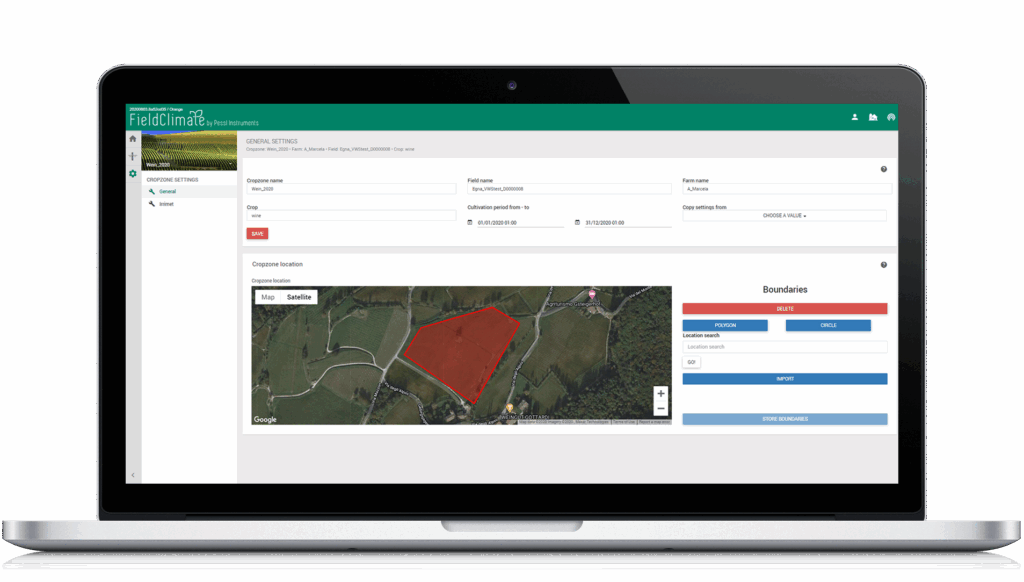
CROPZONES
FarmView works with Cropzones. A Cropzone is a basic unit and represents your field or a portion of your field that is managed identically within given borders during a given time. It is common for a user to define multiple cropzones per field and multiple fields per farm.
IRRIMET
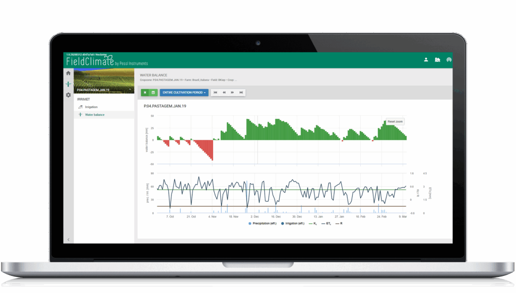
Irrimet is the first service within FarmView. It monitors water stress within your field and supports you by scheduling irrigation events. An interactive calendar helps you to monitor your irrigation events.
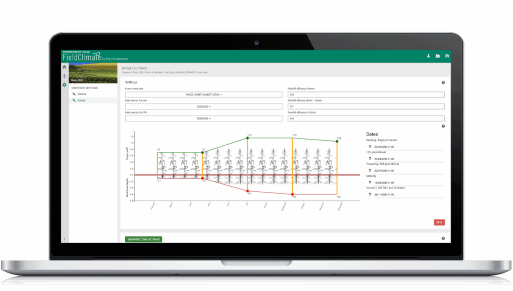
A few inputs and you are set!
- Management dates that cultivation period will take place
- Soil types
- Root depths
- Rainfall patterns
- Crop type
The rest is on us.
Interactive graphs with crop coefficient growth and root depth for full water balance control throughout the season. Receive water content data in mm and in percentage.
PRODUCT VARIATIONS
| FieldClimate | FarmView | FarmView Satellite | |
|---|---|---|---|
|
Overview of all sensor data |
✔ |
✔ |
✔ |
|
Device management – Sensor data and settings |
✔ |
✔ |
✔ |
|
Soil moisture module with plant available water (PAW) indication |
✔ |
✔ |
✔ |
|
Water balance (in mm) |
✖ |
✔ |
✔ |
|
CropZone based visualization |
✖ |
✔ |
✔ |
|
CropZone management page |
✖ |
✔ |
✔ |
|
Cultivation period and plant specific setup |
✖ |
✔ |
✔ |
|
Soil moisture SUM widget |
✖ |
✔ |
✔ |
|
Irrigation planning calendar |
✖ |
✔ |
✔ |
|
Irrimet module |
✖ |
✔ |
✔ |
|
Sentinel-2 satellite CropZone imagery |
✖ |
✖ |
✔ |
|
Biomass LAI charts for cloud-free historic satellite imagery for your fields |
✖ |
✖ |
✔ |
|
Fast access to full history of LAI CropZone maps |
✖ |
✖ |
✔ |
Interested in FarmVIEW?
Fill in the form and we will send you a nonbinding offer